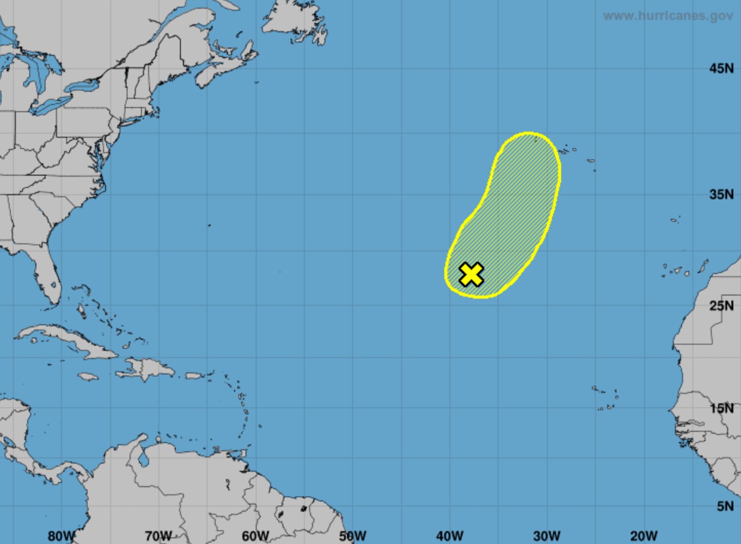
The National Oceanic & Atmospheric Administration’s National Hurricane Center is tracking a storm in the Atlantic Ocean known as Invest 90L. As of the most recent mapping by the NHC, the storm is a straight shot east of the Caribbean Sea, and is projected to take a generally northeast direction. Luckily for residents of Florida’s Atlantic Coast, it does not seem likely from current projections that Invest 90L will move closer to landfall in the coming days and weeks. It is, however, projected to have a 20% chance of becoming a subtropical or tropical storm. “This system could acquire some subtropical or tropical characteristics during the next day or so while it moves northeastward at 15 to 20 mph,” the NHC said in an update Friday afternoon. “Thereafter, the low will be moving over much colder waters ending the chance of subtropical or tropical developments.” The afternoon’s update means a sigh of relief for those still recovering from hurricanes Ian and Nicole in November 2022. Recovery efforts and funds are still at play a year after the storms’ destruction, and so another hurricane making landfall in East Florida would have the potential to devastate the region even more than it already was.
NHC Tracking ‘Invest 90L’ Storm in Atlantic Ocean


